


SKU:WSAL25279
LC29H Series Dual-band GPS Module for Raspberry Pi, Dual-band L1+L5 Positioning Technology, Optional RTK Function
Couldn't load pickup availability
Dual-band L1+L5 | RTK centimeter-level Accuracy | Raw Observation data output
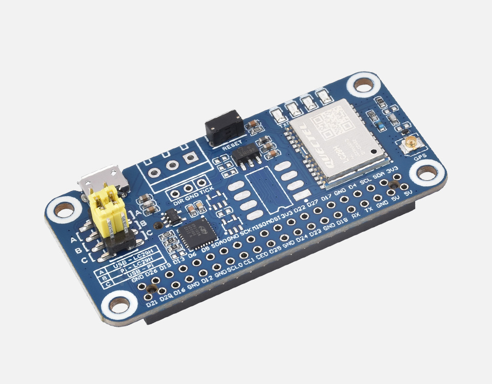
TheLC29H series can track L1+L5 dual-frequency and multi-GNSS signals, reducing multipath effects in urban canyons and improving positioning accuracy while maintaining low power consumption. With built-in LNA and SAW filter to achieve high sensitivity and strong anti-interference capability. Adopts dual-band positioning and RTK technology to meet the need of centimeter-level high-precision positioning. Ideal for real-time tracking systems and sharing economy applications, helping to develop applications such as smart farm machinery and shared two-wheelers, etc.
- Standard Raspberry Pi 40PIN GPIO extension header, supports Raspberry Pi series boards, Jetson Nano
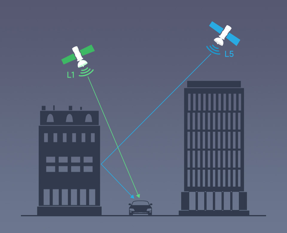
- Supports simultaneous tracking of L1+L5 dual-band satellite signals, reducing multipath effects in urban canyons and improving positioning accuracy
- Supports concurrent receiving of multi-GNSS systems (GPS, BDS, GLONASS, Galileo and QZSS) while maintaining low power consumption
- LC29H(AA) GPS HAT with the following features:
- Supports positioning augmentation systems (WAAS, EGNOS, MSAS and GAGAN) to improve the positioning performance of service areas
- Supports EASY technology, to realize the positioning using stored information such as ephemeris and almanac data when there is no signal, and improve the positioning and time to first fix
- LC29H(DA) GPS/RTK HAT with the following features:
- Supports fast convergence dual-band RTK centimeter-level positioning, suitable for high-precision positioning of terminal devices
- LC29H(BS) GPS/RTK HAT with the following features:
- Supports GNSS raw observation and correction data output, suitable for establishing RTK base station
- Built-in low noise amplifier and acoustic surface filter to realize -165dBm high sensitivity and enhance anti-interference performance
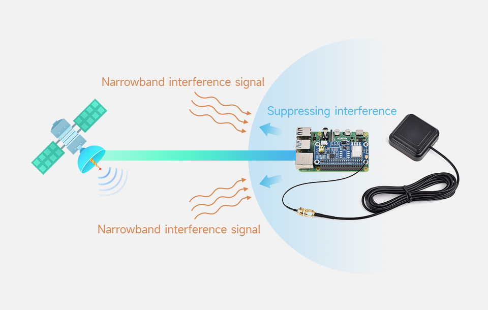
- Supports multi-frequency active interference cancellation, effectively suppressing or eliminating narrowband signal (WiFi/2/3/4/5G) interference to ensure navigation accuracy
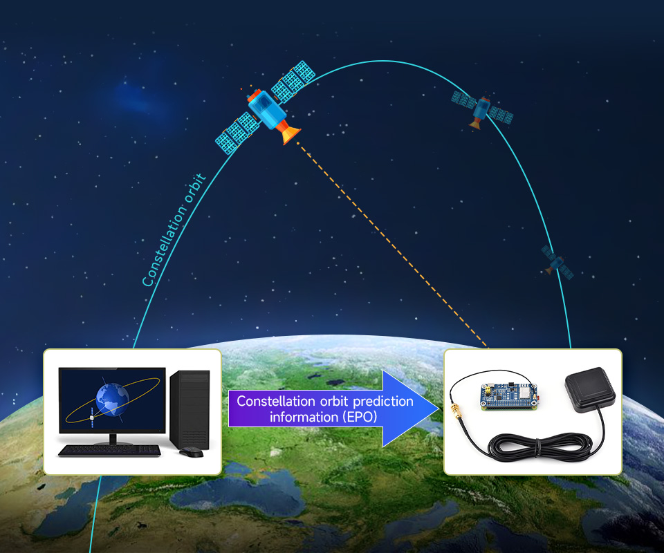
- A-GNSS (Assisted GNSS) support, reducing the time to first fix (TTFF) with cold start when powered on to 5 seconds
- Support QGNSS software, easy to set various module functions
- Onboard battery holder, supports ML1220 rechargeable cell, for preserving ephemeris information and hot starts
- Onboard 4 LED indicators for module operating status
- Comes with online development resources and manual (Python examples for Raspberry Pi/Jetson Nano)
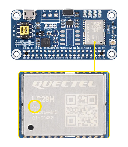
LC29H(AA) GPS HATSupports positioning augmentation system and EASY technology
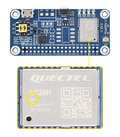
LC29H(DA) GPS/RTK HATSupports RTK Rover to realize high-precision centimeter-level positioning
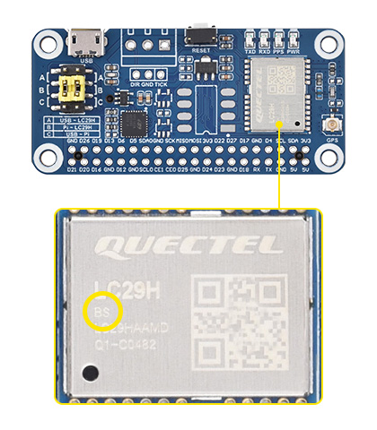
LC29H(BS) GPS/RTK HATSupports RTK Base, can establish a base station to transmit correction data
TIME TO FIRSTTIME TO FIRST
| Product | LG290P GNSS RTK Module | LC29H(AA) GPS HAT | LC29H(DA) GPS/RTK HAT | LC29H(BS) GPS/RTK HAT | ZED-F9P GPS-RTK HAT | |
|---|---|---|---|---|---|---|
| Frequency band | GPS: L1 C/A, L1C*, L5, L2C GLONASS: L1, L2 Galileo: E1, E5a, E5b, E6 BDS: B1I, B1C, B2a, B2b, B2I, B3I QZSS: L1 C/A, L1C*, L5, L2C, L6 NavIC: L5 SBAS: L1 | GPS/QZSS: L1C/A, L5 BDS: B1I, B2a Galileo: E1, E5a GLONASS: L1 | GPS/QZSS: L1C/A, L2C BDS: B1I, B2I Galileo: E1B/C, E5a GLONASS: L1OF, L2OF | |||
| NUMBER OF CONCURRENT GNSS | 5 + QZSS | GPS/QZSS+BDS+Galileo+GLONASS | ||||
| SBAS | WAAS, EGNOS, BDSBAS, MSAS, GAGAN, SDCM | WAAS, EGNOS, MSAS, GAGAN | - | WAAS, EGNOS, MSAS, GAGAN | ||
| RTK Function | RTK Rover and Base | - | RTK Rover | RTK Base | RTK Rover and Base | |
| Positioning Accuracy | PVT | 0.7m CEP | 1m CEP | - | 1.5m CEP | |
| RTK | 0.8cm + 1ppm CEP | - | 0.01m+1ppm CEP | - | 0.01m+1ppm CEP | |
| Navigation Update Rate | PVT | Default: 10Hz Max.: 20Hz | 1~10Hz | - | 1~10Hz | |
| RTK | - | 1Hz | - | 1~8Hz | ||
| RAW | 1Hz | 1~20Hz | ||||
| RTK Convergence Time | <5s | - | <10s | - | <10s | |
| Time to first fix (AGNSS Off) | Cold starts | 28s | 26s | - | 24s | |
| Hot starts | 1.7s | 1s | - | 2s | ||
| Warm starts | 28s | 16s | - | 2s | ||
| Time to first fix (EASY on) | - | 2s | - | |||
| Time to first fix (AGNSS On) | Cold starts | - | 5s | - | TBD | |
| Hot starts | - | 5s | - | TBD | ||
| Warm starts | - | 5s | - | TBD | ||
| Sensitivity | Tracking and navigating | -160dBm | -165dBm | -167dBm | ||
| Re-acquisition | -155dBm | -159dBm | -157dBm | -159dBm | -160dBm | |
| Cold starts | -146dBm | -147dBm | -145dBm | -147dBm | -148dBm | |
| Velocity accuracy | 0.03m/s | 0.2m/s | - | 0.05m/s | ||
| PPS accuracy | 5ns | 20ns | - | 30ns | ||
| Dynamic performance | Acceleration (Max): 4g | |||||
| Altitude (Max):10000m | Altitude (Max):50000m | |||||
| Velocity (Max): 490m/s | Velocity (Max): 500m/s | |||||
| Communication interface | USB, UART(4800~921600bps, 460800bps by default) | UART(9600~3000000bps, 115200bps by default),I2C(Max 400KHz) | USB, UART(4800~921600bps, 9600bps by default), I2C(Max 400KHz), SPI(5MHz) | |||
| Protocol | NMEA 0183/RTCM 3.x | NMEA 0183 V4.10, RTCM 3.x | NMEA 0183 V4.10,UBX, RTCM 3.3 | |||
| Power supply | 5V | |||||
| Overall Current | <100mA@5V (Continue mode) | <40mA@5V (Continue mode) | <120mA@5V (Continue mode) | |||
| Operating temperature | -40~85℃ | |||||
| Dimensions | 33 × 33 (mm) | 65×30.5mm | ||||
Compatible with Raspberry Pi series boards
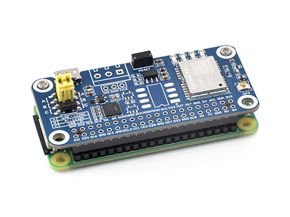
Working With Raspberry Pi Zero
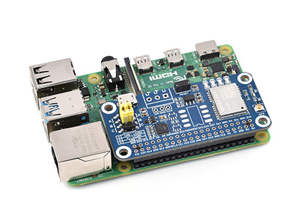
Working with Raspberry Pi 4B
* for reference only, the Raspberry Pi boards are NOT included.
Supports simultaneous tracking of L1+L5 dual-band satellite signalsreducing multipath effects in urban canyons and improving positioning accuracy
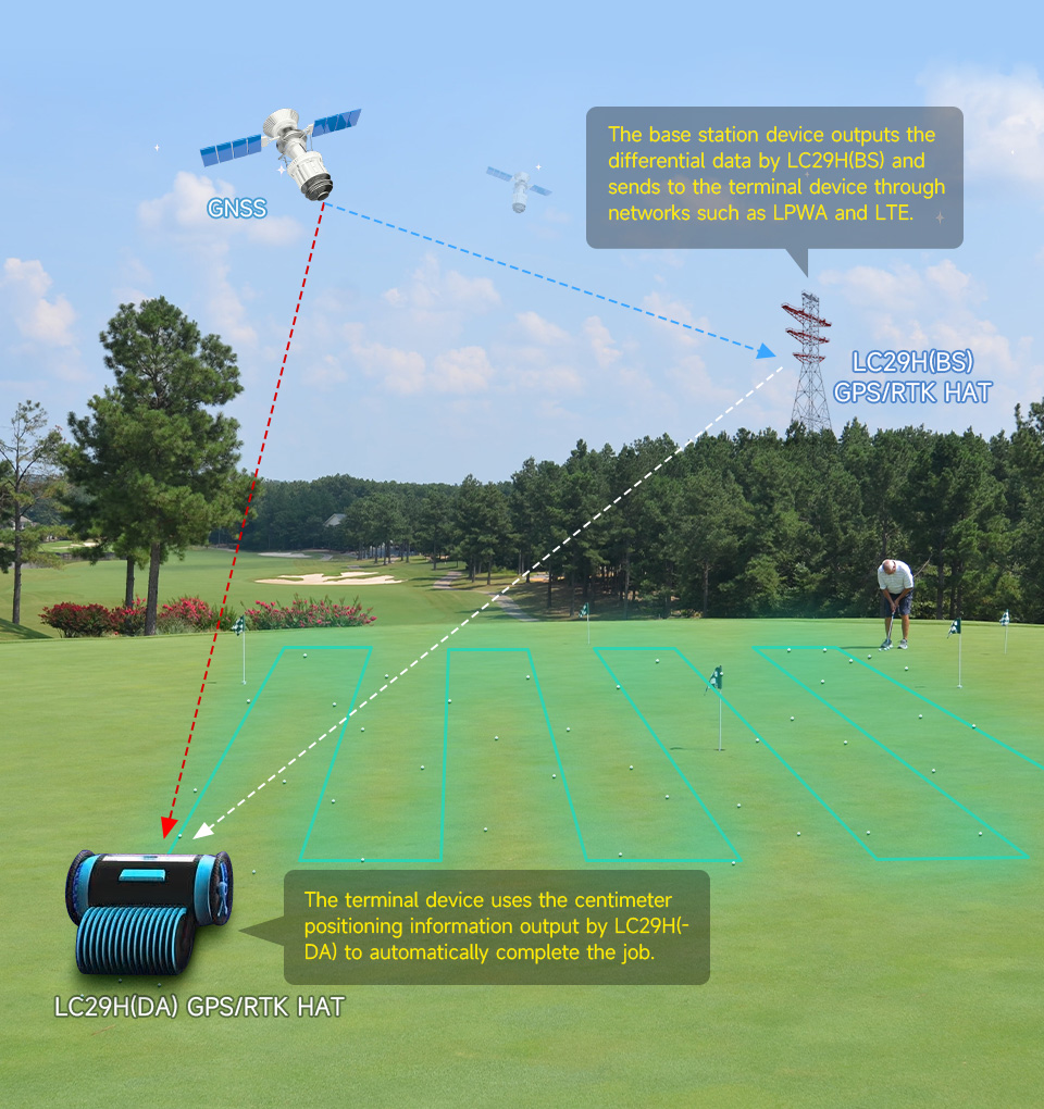
The LC29H(BS) module is used as an RTK Base Station, while the LC29H(DA) module is used as an RTK Mobile Station
By setting up continuous running reference stations on the ground known fixed coordinates using the LC29H (BS) module, or by paid RTK base station enhanced services, transmitting GNSS calibration value to LC29H (DA) terminals which uploading rough positioning data, the terminals, with errors like multipath refraction, is able to calculate error value in real time, for centimeter-level positioning in seconds.
Supports GPS, BDS, GLONASS, Galileo, QZSSand still retains low power consumption

effectively suppressing or eliminating narrowband signal (WiFi/2/3/4/5G) interference to ensure navigation accuracy
reducing the time to first fix (TTFF) with cold start when powered on to 5 seconds
Ideal for real-time tracking systems and sharing economy applications, helping to develop applications such as smart farm machinery and shared two-wheelers, etc.

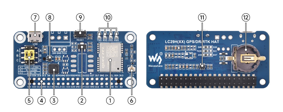
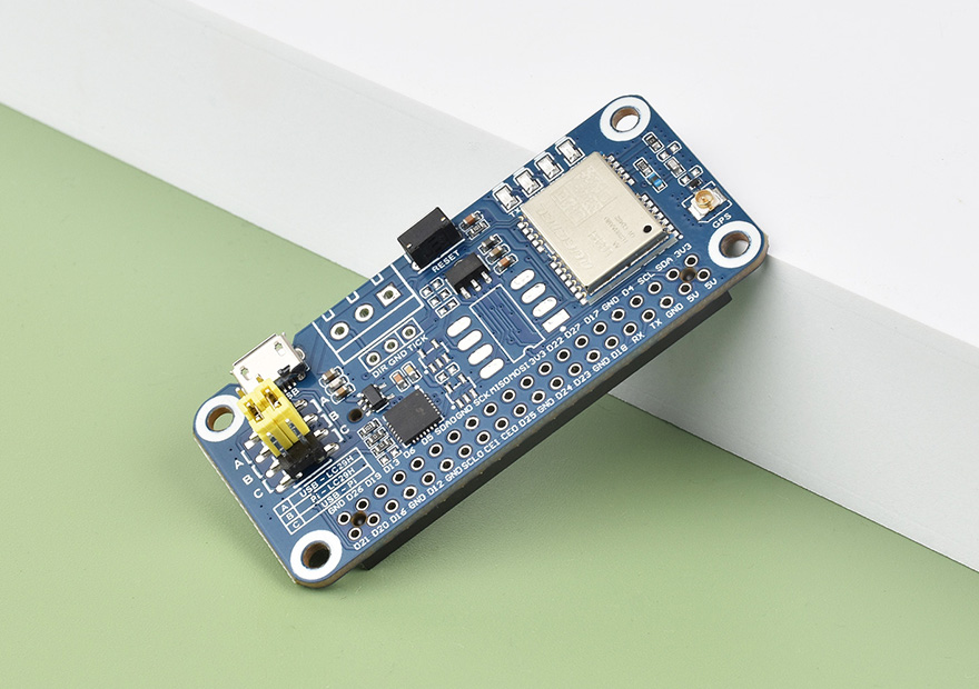
- LC29H module
- RT9166A-28PXL5V to 2.8V LDO chip
- CP2102NUSB to UART chip
- Raspberry Pi 40PIN GPIO headerfor connecting with Raspberry Pi
- UART selection jumperA: control the LC29H via USB to UARTB: control the LC29H via Raspberry PiC: access Raspberry Pi via USB to UART
- IPEX 1 connectorLC29H module antenna connector
- Micro USB interface
- RT9193-33PB5V to 3.3V LDO chip
- RESET buttonreset the LC29H module
- Status Indicators PWR: Power Indicator RXD/TXD: UART transceiver indicator PPS: GPS status indicator
- NDC7002NI2C voltage translator
- ML1220 Battery holdersupports ML1220 rechargeable cell, for preserving ephemeris information and hot start
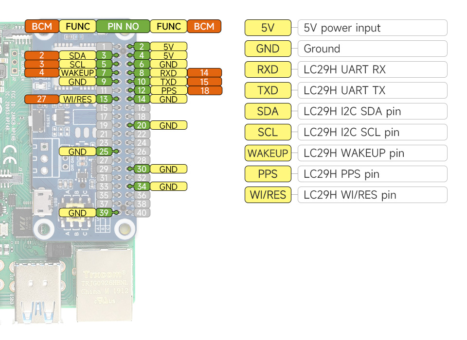
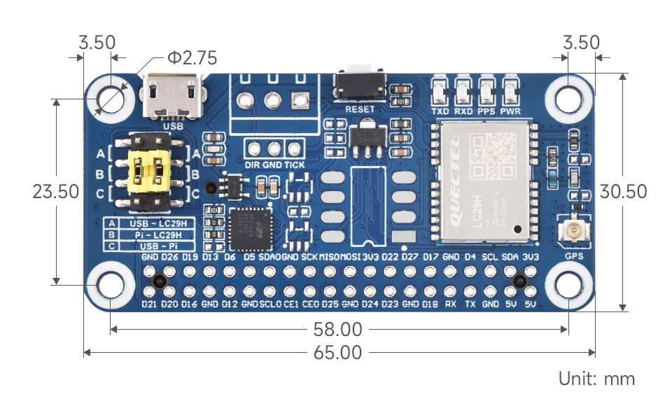


* Resources for different product may vary, please check the wiki page to confirm the actually provided resources.
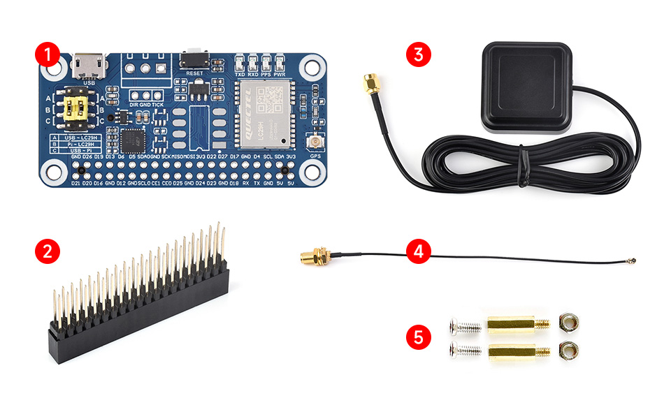
Lieferumfang
- OPTIONS LC29H GPS HAT x1
- 2x20PIN female header x1
- GPS External Antenna (D) x1
- IPEX 1 to SMA cable ~17cm x1
- Screws pack x1
Payment methods
Payment methods


